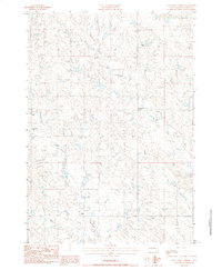
1983 Map of Elevenmile Corner
USGS Topo · Published 1984About this map
Medicine Creek and its many winding tributaries define the rolling prairie of western South Dakota in this early 1980s provisional survey. The landscape is characterized by its expansive ranching heritage, with large landholdings such as Mcllravy Ranch, Lamm Ranch, and Couch Ranch spread across the township. These family names are anchored by the small community at Elevenmile Corner, which serves as a central reference point in this corner of Haakon County.
Find a feature on this map
11 named features on this map. Tap any name to fly to it.
Don’t see what you’re looking for? This feature index may not catch every label — zoom into the map to look around manually.
Map Details
Editions of this 1983 Elevenmile Corner Map
This is the sole edition of this map. No revisions or reprints were ever made.
Other maps of this area

1953 · Philip
USGS Topo · 1:24,000

1953 · Philip SE
USGS Topo · 1:24,000

1954 · Pierre
USGS Topo · 1:250,000

1958 · Pierre
USGS Topo · 1:250,000

1983 · Philip
USGS Topo · 1:100,000

1983 · Hilland
USGS Topo · 1:24,000
1983 · Bowen Ranch
USGS Topo · 1:24,000

1983 · Tornado Ranch
USGS Topo · 1:24,000
1983 · Lucerne
USGS Topo · 1:24,000
1983 · Grindstone Butte
USGS Topo · 1:24,000