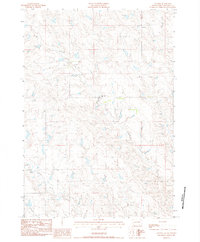
1983 Map of Lucerne
USGS Topo · Published 1984About this map
Medicine Creek and its various tributaries define this section of the western South Dakota plains in the early 1980s. The landscape is marked by the small settlement of Lucerne, which serves as a focal point for this expansive rangeland. The presence of the Old Trail Sch near the center of the quadrangle suggests the enduring importance of localized education centers in this sparsely populated region.
Find a feature on this map
8 named features on this map. Tap any name to fly to it.
Don’t see what you’re looking for? This feature index may not catch every label — zoom into the map to look around manually.
Map Details
Editions of this 1983 Lucerne Map
This is the sole edition of this map. No revisions or reprints were ever made.
Other maps of this area

1953 · Philip
USGS Topo · 1:24,000

1953 · Philip SE
USGS Topo · 1:24,000

1954 · Powell
USGS Topo · 1:24,000

1954 · Pierre
USGS Topo · 1:250,000

1958 · Pierre
USGS Topo · 1:250,000

1983 · Mule Creek
USGS Topo · 1:24,000

1983 · Philip
USGS Topo · 1:100,000
1983 · Elevenmile Corner
USGS Topo · 1:24,000

1983 · Powell NW
USGS Topo · 1:24,000

1983 · Tornado Ranch
USGS Topo · 1:24,000