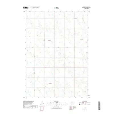
2017 Map of Lucerne
USGS Topo · Published 2017About this map
Lucerne stands at the intersection of a vast section-line road network in the northern reaches of Haakon County. The 2017 landscape is defined by the winding drainages of Buzzard Cr and Witcher Holes Cr, which carve through the high plains. The map reveals a strictly organized rural geography, where long-established range lines like t3n r21e and t2n r22e dictate the placement of local thoroughfares such as 11 Mile Rd and 229th Ave. In the southern portion of the quadrangle, the terrain transitions toward the headwaters of Medicine Cr and Wilburn Cr. The presence of Airport Rd cutting north-to-south suggests the importance of aerial access in this remote ranching country, where the distance between neighbors is measured in miles and miles of open prairie.
Find a feature on this map
15 named features on this map. Tap any name to fly to it.
Don’t see what you’re looking for? This feature index may not catch every label — zoom into the map to look around manually.
Map Details
Editions of this 2017 Lucerne Map
This is the sole edition of this map. No revisions or reprints were ever made.
Other maps of this area

1953 · Philip
USGS Topo · 1:24,000

1953 · Philip SE
USGS Topo · 1:24,000

1954 · Powell
USGS Topo · 1:24,000

1954 · Pierre
USGS Topo · 1:250,000

1958 · Pierre
USGS Topo · 1:250,000

1983 · Mule Creek
USGS Topo · 1:24,000

1983 · Philip
USGS Topo · 1:100,000
1983 · Elevenmile Corner
USGS Topo · 1:24,000

1983 · Powell NW
USGS Topo · 1:24,000

1983 · Tornado Ranch
USGS Topo · 1:24,000