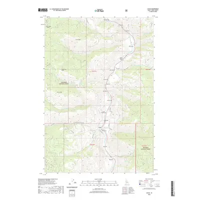
2020 Map of Lucile
USGS Topo · Published 2020About this map
Lucile serves as the focal point along the canyon floor, where the Salmon River cuts through the high plateaus and ridges of the Nez Perce National Forest. The landscape is defined by its dramatic verticality, from the high points of Center Ridge and Johnson Ridge down to a series of riverside alluvial features known locally as bars. These stretches of level ground, such as Lucile Bar, Sherwin Bar, and Butcher Bar, represent the rare habitable and workable spaces within the steep river corridor. The map details an intricate network of drainage systems, including Christie Cr and Cow Cr, while roads like McKinley Mine Rd and Seven U Ranch Rd suggest the region's historical reliance on mineral extraction and livestock. This 2020 survey illustrates how topography continues to dictate settlement patterns, confining development to the narrow margins of the river and the gaps between massive ridges like Mud Springs Ridge.
Find a feature on this map
56 named features on this map. Tap any name to fly to it.
Don’t see what you’re looking for? This feature index may not catch every label — zoom into the map to look around manually.
Map Details
Editions of this 2020 Lucile Map
This is the sole edition of this map. No revisions or reprints were ever made.
Other maps of this area

1938 · Riggins
USGS Topo · 1:96,000

1945 · Riggins
USGS Topo · 1:125,000

1955 · Grangeville
USGS Topo · 1:250,000

1959 · Grangeville
USGS Topo · 1:250,000

1963 · John Day Mtn
USGS Topo · 1:24,000

1963 · Lucile
USGS Topo · 1:24,000

1963 · McKinzie Creek
USGS Topo · 1:24,000

1963 · Slate Creek
USGS Topo · 1:24,000

1963 · Kirkwood Creek
USGS Topo · 1:24,000

1963 · Grave Point
USGS Topo · 1:24,000