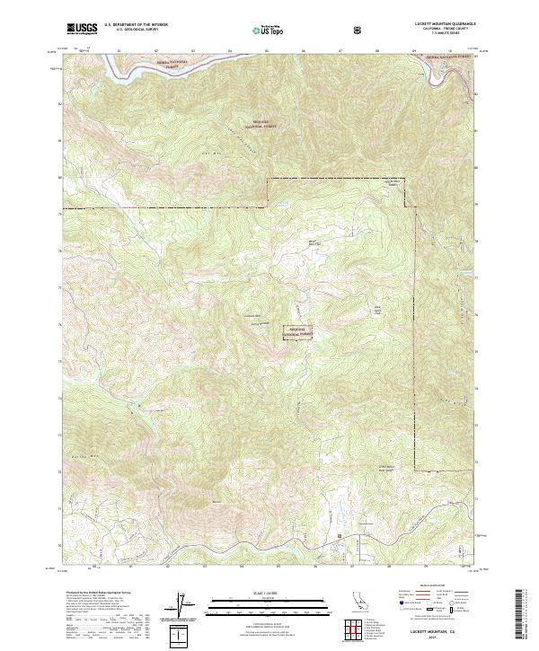
2021 Map of Luckett Mountain
USGS Topo · Published 2021About this map
Luckett Mtn and the high ridges of the Sierra Nevada dominate this landscape where the Sierra National Forest and Sequoia National Forest meet. The northern edge is defined by the winding course of the Kings River, while the southern reaches are marked by more recent road development along E Kings Canyon Rd. The terrain is characterized by a series of flats and saddles, such as Alex Jones Flat, White Deer Flat, and White Deer Saddle, which provided navigable pockets within the steep canyons. This geography highlights the significance of water sources like Blue Clay Spring and Coyote Springs Cr for both natural ecosystems and human activity in these high elevations. Toward the southeast, named ridges like Pine Ridge and Dude Ridge overlook Little White Deer Valley, reflecting a long history of local place-naming by early settlers and foresters.
Find a feature on this map
44 named features on this map. Tap any name to fly to it.
Don’t see what you’re looking for? This feature index may not catch every label — zoom into the map to look around manually.
Map Details
Editions of this 2021 Luckett Mountain Map
This is the sole edition of this map. No revisions or reprints were ever made.
Other maps of this area

1921 · Squaw Valley
USGS Topo · 1:31,680

1922 · Trimmer
USGS Topo · 1:96,000

1924 · Citrus Cove
USGS Topo · 1:31,680

1924 · Dinuba
USGS Topo · 1:125,000

1942 · Watts Valley
USGS Topo · 1:62,500

1942 · Dunlap
USGS Topo · 1:62,500

1944 · Watts Valley
USGS Topo · 1:62,500

1944 · Dunlap
USGS Topo · 1:62,500

1948 · Fresno
USGS Topo · 1:250,000
1950 · Orange Cove North
USGS Topo · 1:24,000