
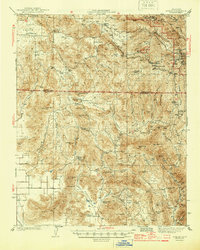
1944 Map of Dunlap
USGS Topo · Published 1944About this map
Squaw Valley and the high ranching country of the Sierra Nevada foothills define this 1940s landscape. Early educational and community foundations are evident through scattered local landmarks like the Squaw Valley Sch, Drum Valley Sch, and the spiritual retreat at Bethesda Springs. The terrain is marked by a complex network of canyons and flats, where small settlements like Dunlap and Miramonte serve as anchors for the surrounding livestock operations.
Find a feature on this map
70 named features on this map. Tap any name to fly to it.
Don’t see what you’re looking for? This feature index may not catch every label — zoom into the map to look around manually.
Map Details
Editions of this 1944 Dunlap Map
2 editions found
Other maps of this area

1903 · Tehipite
USGS Topo · 1:125,000

1904 · Kaweah
USGS Topo · 1:125,000

1905 · Tehipite
USGS Topo · 1:125,000

1909 · Kaweah
USGS Topo · 1:125,000

1921 · Squaw Valley
USGS Topo · 1:31,680

1921 · Stokes Mountain
USGS Topo · 1:24,000

1922 · Trimmer
USGS Topo · 1:96,000

1923 · Sultana
USGS Topo · 1:31,680

1924 · Citrus Cove
USGS Topo · 1:31,680

1924 · Dinuba
USGS Topo · 1:125,000