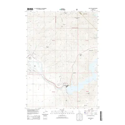
2013 Map of Lucky Peak
USGS Topo · Published 2013About this map
Lucky Peak Lake dominates the eastern landscape of this Boise-area survey, where the Lucky Peak Dam controls the waters of the Boise River. The map highlights the sophisticated water management infrastructure required for the Boise Valley, notably the New York Canal and the Penitentiary Canal which draw from the river downstream of the dam. To the north and west, the terrain rises sharply into the Boise National Forest, marked by prominent peaks such as Lucky Peak and Shaw Mtn. The settlement of Barber sits along the river's edge, reflecting the area's development near the mouth of the canyon. Outdoor recreation areas like Sandy Point Beach and the Sheep Creek Access Area illustrate the dual-purpose nature of the reservoir system, balancing regional irrigation needs with public access. Higher elevations are traversed by winding routes like Shaw Mountain Rd and Deer Creek Rd, crossing through deep drainages such as Schoonover Gulch and Maynard Gulch.
Find a feature on this map
45 named features on this map. Tap any name to fly to it.
Don’t see what you’re looking for? This feature index may not catch every label — zoom into the map to look around manually.
Map Details
Editions of this 2013 Lucky Peak Map
This is the sole edition of this map. No revisions or reprints were ever made.
Other maps of this area

1892 · Mountain Home
USGS Topo · 1:125,000

1892 · Boise
USGS Topo · 1:125,000

1892 · Bisuka
USGS Topo · 1:125,000

1893 · Mountain Home
USGS Topo · 1:125,000

1894 · Bisuka
USGS Topo · 1:125,000

1894 · Idaho Basin
USGS Topo · 1:125,000

1897 · Boise
USGS Topo · 1:125,000

1949 · Robie Creek
USGS Topo · 1:24,000

1954 · Boise South
USGS Topo · 1:24,000

1954 · Boise North
USGS Topo · 1:24,000