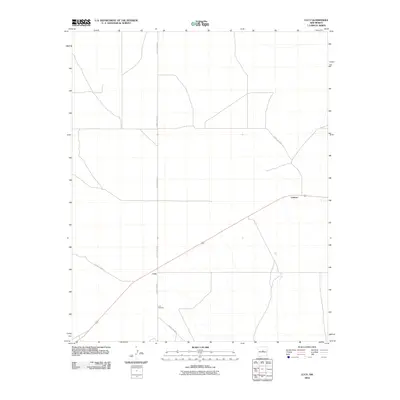
2010 Map of Lucy
USGS Topo · Published 2010About this map
Lucy and the small settlement of Culebra anchor this arid landscape in central New Mexico, where life is defined by the intersection of rail lines and county roads. The settlement patterns reflect a rural persistence, with the Lucy Cemetery serving as a significant genealogical landmark for families of the Estancia Valley. This 2010 survey illustrates a network of essential thoroughfares including County Rd-A129 and County Rd-B033, which connect these small hubs to the surrounding ranching and agricultural lands. The map captures a moment of modern stillness in a region shaped by transport routes, preserving the exact locations of local markers and family-history sites before the landscape inevitably shifts.
Find a feature on this map
9 named features on this map. Tap any name to fly to it.
Don’t see what you’re looking for? This feature index may not catch every label — zoom into the map to look around manually.
Map Details
Editions of this 2010 Lucy Map
This is the sole edition of this map. No revisions or reprints were ever made.
Other maps of this area

1954 · Fort Sumner
USGS Topo · 1:250,000

1958 · Fort Sumner
USGS Topo · 1:250,000

1960 · Lobo Hill
USGS Topo · 1:62,500

1978 · Laguna Del Perro North
USGS Topo · 1:24,000

1978 · Negra SW
USGS Topo · 1:24,000

1978 · Pedernal Mountain
USGS Topo · 1:24,000

1978 · Pedernal
USGS Topo · 1:24,000

1978 · Laguna Del Perro South
USGS Topo · 1:24,000

1978 · Lucy
USGS Topo · 1:24,000

1978 · Rattlesnake Hill
USGS Topo · 1:24,000