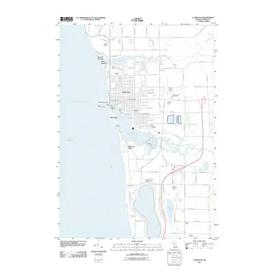
2011 Map of Ludington
USGS Topo · Published 2011About this map
Ludington is defined by its deep relationship with the water, serving as a hub between the expanse of Lake Michigan and the sheltered waters of Pere Marquette Lake. The city's maritime infrastructure is prominent, featuring the North Breakwater Light, North Pierhead Light, and South Breakwater Light guiding vessels into the harbor. Waterfront activity is concentrated around facilities like the Ludington Municipal Marina, Harbor View Marina, and the Tamarac Sport Fishing Dock.
Find a feature on this map
100 named features on this map. Tap any name to fly to it.
Don’t see what you’re looking for? This feature index may not catch every label — zoom into the map to look around manually.
Map Details
Editions of this 2011 Ludington Map
This is the sole edition of this map. No revisions or reprints were ever made.
Other maps of this area

1931 · Manistee SE
USGS Topo · 1:31,680

1931 · Manistee SW
USGS Topo · 1:31,680

1932 · Ludington NE
USGS Topo · 1:31,680

1932 · Ludington SW
USGS Topo · 1:31,680

1932 · Ludington SE
USGS Topo · 1:31,680

1932 · Ludington
USGS Topo · 1:31,680

1954 · Milwaukee
USGS Topo · 1:250,000

1954 · Manitowoc
USGS Topo · 1:250,000

1958 · Manitowoc
USGS Topo · 1:250,000

1958 · Milwaukee
USGS Topo · 1:250,000
Featured Places
- Ludington, MI
- Pere Marquette Charter Township, MI
- Victory Township, MI
- Amber Township, MI
- Buttersville, MI