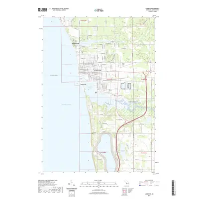
2019 Map of Ludington
USGS Topo · Published 2019About this map
Ludington sits as the central hub of this coastal survey, defined by its position between the expansive Lake Michigan and the sheltered Pere Marquette Lake. The street grid of the city center is anchorerd by the Mason County Courthouse, while outlying areas include the settlements of North Epworth and Buttersville. The landscape is deeply tied to its water systems, including the protected Pere Marquette Wild and Scenic River and the northern reaches of Lincoln Lake. Local history and genealogy are well-represented by several burial grounds, such as Lakeview Cem, Pere Marquette Cem, and Phillips Cem. To the east, the Mason County Airport and the meandering paths of the Lincoln River and Marquette River showcase the region's transition from an urban lakeside port to a more natural, wooded interior.
Find a feature on this map
128 named features on this map. Tap any name to fly to it.
Don’t see what you’re looking for? This feature index may not catch every label — zoom into the map to look around manually.
Map Details
Editions of this 2019 Ludington Map
This is the sole edition of this map. No revisions or reprints were ever made.
Other maps of this area

1931 · Manistee SE
USGS Topo · 1:31,680

1931 · Manistee SW
USGS Topo · 1:31,680

1932 · Ludington NE
USGS Topo · 1:31,680

1932 · Ludington SW
USGS Topo · 1:31,680

1932 · Ludington SE
USGS Topo · 1:31,680

1932 · Ludington
USGS Topo · 1:31,680

1954 · Milwaukee
USGS Topo · 1:250,000

1954 · Manitowoc
USGS Topo · 1:250,000

1958 · Manitowoc
USGS Topo · 1:250,000

1958 · Milwaukee
USGS Topo · 1:250,000
Featured Places
- Ludington, MI
- Pere Marquette Charter Township, MI
- Victory Township, MI
- Amber Township, MI
- Buttersville, MI