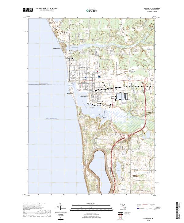
2023 Map of Ludington
USGS Topo · Published 2023About this map
Ludington's lakefront serves as a primary Michigan hub for transportation and recreation along the eastern shore of Lake Michigan. The landscape is defined by its industrial and maritime history, where the Pere Marquette River flows into Pere Marquette Lake, supporting the Lake Michigan Car Ferry operations. To the north, the Lincoln River and Lincoln Lake create a natural buffer near North Epworth, while the southern reaches near Buttersville show a complex network of wetlands and creeks like Swanson Creek. The town's civic core is anchored by the Mason County Courthouse, with several local landmarks including Lakeview Cem and the Mason County Airport appearing further inland. This survey documents the modern street grid and drainage patterns, from Burr Creek to Hopkins Lake, reflecting the region's enduring reliance on its freshwater connections and coastal position.
Find a feature on this map
129 named features on this map. Tap any name to fly to it.
Don’t see what you’re looking for? This feature index may not catch every label — zoom into the map to look around manually.
Map Details
Editions of this 2023 Ludington Map
This is the sole edition of this map. No revisions or reprints were ever made.
Other maps of this area

1931 · Manistee SE
USGS Topo · 1:31,680

1931 · Manistee SW
USGS Topo · 1:31,680

1932 · Ludington NE
USGS Topo · 1:31,680

1932 · Ludington SW
USGS Topo · 1:31,680

1932 · Ludington SE
USGS Topo · 1:31,680

1932 · Ludington
USGS Topo · 1:31,680

1954 · Milwaukee
USGS Topo · 1:250,000

1954 · Manitowoc
USGS Topo · 1:250,000

1958 · Manitowoc
USGS Topo · 1:250,000

1958 · Milwaukee
USGS Topo · 1:250,000
Featured Places
- Ludington, MI
- Pere Marquette Charter Township, MI
- Summit Township, MI
- Victory Township, MI
- Riverton Township, MI