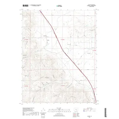
2019 Map of Ludlow
USGS Topo · Published 2019About this map
The Ludlow Massacre Memorial Site stands as a solemn landmark on this Las Animas County landscape, marking a pivotal moment in American labor history just north of the Ludlow settlement. The terrain is defined by a dense network of drainages and canyons, including Del Aqua Arroyo and the deeply carved Chicosa Canyon, which intersect the high plains. Historically significant routes such as Old Wagon Trail Rd and Berwind Rd trace the paths through the complex topography toward Tollerburg Flats. The map reveals the intricate relationship between the region's coal-mining past and its natural geography, with Berwind Canyon and Canyon del Agua cutting through the western ridges. These landforms provide context for the isolated settlements and historical industrial sites that once thrived in this corner of Colorado.
Find a feature on this map
62 named features on this map. Tap any name to fly to it.
Don’t see what you’re looking for? This feature index may not catch every label — zoom into the map to look around manually.
Map Details
Editions of this 2019 Ludlow Map
This is the sole edition of this map. No revisions or reprints were ever made.
Other maps of this area

1891 · Spanish Peaks
USGS Topo · 1:125,000

1892 · Elmoro
USGS Topo · 1:125,000

1893 · Spanish Peaks
USGS Topo · 1:125,000

1893 · Elmoro
USGS Topo · 1:125,000

1895 · Spanish Peaks
USGS Topo · 1:125,000

1897 · Elmoro
USGS Topo · 1:125,000

1897 · Spanish Peaks
USGS Topo · 1:125,000

1900 · Spanish Peaks
USGS Topo · 1:125,000

1951 · Trinidad
USGS Topo · 1:24,000

1951 · Madrid
USGS Topo · 1:24,000