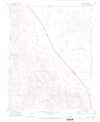
1971 Map of Ludlow
USGS Topo · Published 1974About this map
The Ludlow Memorial stands as a somber landmark on this landscape, marking a site of deep significance for Colorado's industrial and labor history. Situated along the tracks of the Colorado and Southern railroad, the small settlement of Ludlow is flanked by evidence of the region’s extensive coal mining legacy. To the west, the Berwind Ruins and various Mines tucked into Berwind Canyon illustrate the once-active mining camps that carved into the foothills of the Black Hills. This 1971 field-checked map reveals a terrain heavily shaped by extraction and transportation, where an Old Railroad Grade and the Hoehne Road navigate between deep drainages like Arroyo Del Agua and Chicosa Arroyo. From the Ramey Mines to the Majestic Mine, the document provides a detailed record of the pits and adits that defined the local economy during the early to mid-20th century.
Find a feature on this map
31 named features on this map. Tap any name to fly to it.
Don’t see what you’re looking for? This feature index may not catch every label — zoom into the map to look around manually.
Map Details
Editions of this 1971 Ludlow Map
This is the sole edition of this map. No revisions or reprints were ever made.
Other maps of this area

1891 · Spanish Peaks
USGS Topo · 1:125,000

1892 · Elmoro
USGS Topo · 1:125,000

1893 · Spanish Peaks
USGS Topo · 1:125,000

1893 · Elmoro
USGS Topo · 1:125,000

1895 · Spanish Peaks
USGS Topo · 1:125,000

1897 · Elmoro
USGS Topo · 1:125,000

1897 · Spanish Peaks
USGS Topo · 1:125,000

1900 · Spanish Peaks
USGS Topo · 1:125,000

1951 · Trinidad
USGS Topo · 1:24,000

1951 · Madrid
USGS Topo · 1:24,000