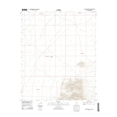
2013 Map of Luera Mountains NW
USGS Topo · Published 2013About this map
Plains of San Agustin dominate the western half of this Catron County landscape, representing a significant high-altitude basin floor in the New Mexico backcountry. The terrain shifts dramatically in the southeastern corner as the topography rises into the Luera Mountains, where the elevation gain is marked by closely spaced contour intervals and complex ridge systems. This 2013 survey illustrates a section of the American West defined by its lack of established settlements, focusing instead on the vast physical geography and the Public Land Survey System divisions between T3S and T5S. The transition from the flat, arid basin of the plains to the volcanic-associated peaks of the Luera range highlights the classic geological diversity of this region.
Find a feature on this map
8 named features on this map. Tap any name to fly to it.
Don’t see what you’re looking for? This feature index may not catch every label — zoom into the map to look around manually.
Map Details
Editions of this 2013 Luera Mountains NW Map
This is the sole edition of this map. No revisions or reprints were ever made.
Other maps of this area
1918 · Pelona
USGS Topo · 1:125,000

1954 · Tularosa
USGS Topo · 1:250,000

1954 · Clifton
USGS Topo · 1:250,000

1954 · Saint Johns
USGS Topo · 1:250,000

1954 · Socorro
USGS Topo · 1:250,000

1957 · Clifton
USGS Topo · 1:250,000

1957 · Saint Johns
USGS Topo · 1:250,000

1958 · Socorro
USGS Topo · 1:250,000

1958 · Clifton
USGS Topo · 1:250,000

1958 · Tularosa
USGS Topo · 1:250,000