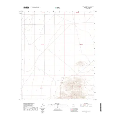
2023 Map of Luera Mountains NW
USGS Topo · Published 2023About this map
Luera Mountains dominate the southeastern portion of this terrain, where steep contour gradients define a sharp rise from the surrounding plains of Catron County. The landscape is characterized by a series of expansive township and range divisions, including t3s r11w, t3s r10w, and t4s r11w, which illustrate the systematic surveying of the American West. A single prominent road traverses the central section of the map, providing the primary point of access across these high-altitude grasslands and volcanic features. This 2023 edition reflects the modern topographical state of the region as documented by the U.S. Geological Survey, showing the spatial relationship between public land survey boundaries and the natural topography of the mountain range.
Find a feature on this map
7 named features on this map. Tap any name to fly to it.
Don’t see what you’re looking for? This feature index may not catch every label — zoom into the map to look around manually.
Map Details
Editions of this 2023 Luera Mountains NW Map
This is the sole edition of this map. No revisions or reprints were ever made.
Other maps of this area

1918 · Pelona
USGS Topo · 1:125,000

1954 · Tularosa
USGS Topo · 1:250,000

1954 · Clifton
USGS Topo · 1:250,000

1954 · Saint Johns
USGS Topo · 1:250,000

1954 · Socorro
USGS Topo · 1:250,000

1957 · Clifton
USGS Topo · 1:250,000

1957 · Saint Johns
USGS Topo · 1:250,000

1958 · Socorro
USGS Topo · 1:250,000

1958 · Clifton
USGS Topo · 1:250,000

1958 · Tularosa
USGS Topo · 1:250,000