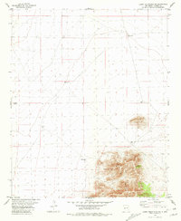
1981 Map of Luera Mountains NW
USGS Topo · Published 1981About this map
The Luera Mountains dominate the southeastern portion of this Catron County landscape, where the high desert terrain rises sharply from the surrounding plains. In this arid reach of New Mexico, the distribution of water sources reveals the vital infrastructure of ranching and survival. A network of widely spaced landmarks such as Sanchez Well 6899, Navajo Well, and Granoso Well indicates a reliance on deep groundwater across the open range. The map documents an intricate system of land management, marked by fine dashed lines representing selected fence lines that divide the sections. From the elevations of Sheep Well to the lower reaches near Middle Well 6860, the survey provides a precise accounting of the sparse but critical resources that supported the pastoral economy of the region during the early 1980s.
Find a feature on this map
10 named features on this map. Tap any name to fly to it.
Don’t see what you’re looking for? This feature index may not catch every label — zoom into the map to look around manually.
Map Details
Editions of this 1981 Luera Mountains NW Map
This is the sole edition of this map. No revisions or reprints were ever made.
Other maps of this area

1918 · Pelona
USGS Topo · 1:125,000

1954 · Tularosa
USGS Topo · 1:250,000

1954 · Clifton
USGS Topo · 1:250,000

1954 · Saint Johns
USGS Topo · 1:250,000

1954 · Socorro
USGS Topo · 1:250,000

1957 · Clifton
USGS Topo · 1:250,000

1957 · Saint Johns
USGS Topo · 1:250,000

1958 · Socorro
USGS Topo · 1:250,000

1958 · Clifton
USGS Topo · 1:250,000

1958 · Tularosa
USGS Topo · 1:250,000