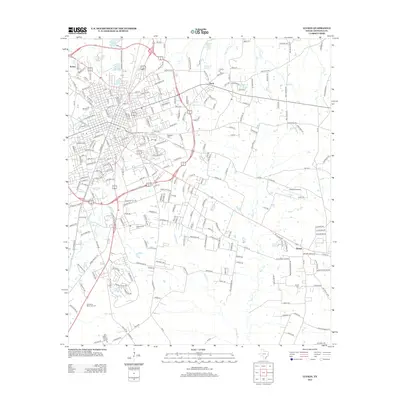
2013 Map of Lufkin
USGS Topo · Published 2013About this map
Keltys and Herty flank the northern reaches of this East Texas corridor, where industrial and residential networks converge. The landscape is defined by the drainage of Biloxi Cr and Hurricane Cr, with several small water bodies like Lake Myriad and Jones Lake dotting the northern terrain. For those tracing family histories, several burial grounds are scattered throughout the quadrangle, including Glendale Cem, Whitehouse Cem, and the Garden of Memories Cem. The presence of Angelina College and Hubbard Airport highlights the mid-century institutional and transportation development of the region. Farther south, the settlement of Homer sits near the old Homer Cemetery Rd, marking an area with deep local roots along the road to McAdams Dr.
Find a feature on this map
236 named features on this map. Tap any name to fly to it.
Don’t see what you’re looking for? This feature index may not catch every label — zoom into the map to look around manually.
Map Details
Editions of this 2013 Lufkin Map
This is the sole edition of this map. No revisions or reprints were ever made.
Other maps of this area

1932 · Manning
USGS Topo · 1:62,500

1949 · Lufkin
USGS Topo · 1:62,500

1949 · Platt
USGS Topo · 1:24,000

1949 · Clawson
USGS Topo · 1:24,000

1949 · Lufkin
USGS Topo · 1:24,000

1949 · Huntington
USGS Topo · 1:24,000

1949 · Keltys
USGS Topo · 1:24,000

1950 · Platt
USGS Topo · 1:24,000

1950 · Keltys
USGS Topo · 1:24,000

1950 · Lufkin
USGS Topo · 1:24,000