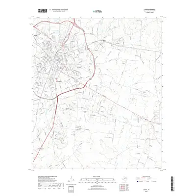
2019 Map of Lufkin
USGS Topo · Published 2019About this map
Lufkin serves as the bustling centerpiece of this 2019 survey, surrounded by established communities like Keltys, Herty, and the historic settlement of Homer. The map details a landscape defined by its creek systems and small reservoirs, including Hurricane Cr, Biloxi Cr, and Lake Myriad. Extensive residential growth and a dense network of roads such as S John Redditt Dr and E Denman Ave reflect the city's modern expansion into the East Texas piney woods.
Find a feature on this map
74 named features on this map. Tap any name to fly to it.
Don’t see what you’re looking for? This feature index may not catch every label — zoom into the map to look around manually.
Map Details
Editions of this 2019 Lufkin Map
This is the sole edition of this map. No revisions or reprints were ever made.
Other maps of this area

1932 · Manning
USGS Topo · 1:62,500

1949 · Lufkin
USGS Topo · 1:62,500

1949 · Platt
USGS Topo · 1:24,000

1949 · Clawson
USGS Topo · 1:24,000

1949 · Lufkin
USGS Topo · 1:24,000

1949 · Huntington
USGS Topo · 1:24,000

1949 · Keltys
USGS Topo · 1:24,000

1950 · Platt
USGS Topo · 1:24,000

1950 · Keltys
USGS Topo · 1:24,000

1950 · Lufkin
USGS Topo · 1:24,000