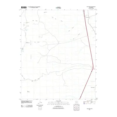
2010 Map of Luis Lopez
USGS Topo · Published 2010About this map
Luis Lopez and San Antonio anchor the eastern corridor of this landscape, situated along the major transportation routes that follow the Rio Grande valley. To the west, the terrain rises sharply into the Chupadera Mountains, where the economy of the early 21st century is defined by ranching and legacy mining operations. Features like the Jacobo Sedillo Ranch and Nogal Ranch indicate the continued agricultural use of the land, while a concentration of mining sites including the Grand Canyon Mine, Tower Mine, and Mancy Mine suggest a history of mineral exploration in the canyons. The geography is deeply dissected by drainage systems such as Black Canyon, Blue Canyon, and Red Canyon, which flow eastward toward the valley from the high ground of Table Mountain. This period shows the intersection of modern interstate travel with traditional land holdings and the geological remains of local industry.
Find a feature on this map
22 named features on this map. Tap any name to fly to it.
Don’t see what you’re looking for? This feature index may not catch every label — zoom into the map to look around manually.
Map Details
Editions of this 2010 Luis Lopez Map
This is the sole edition of this map. No revisions or reprints were ever made.
Other maps of this area

1906 · Socorro
USGS Topo · 1:62,500

1916 · La Joya
USGS Topo · 1:125,000

1948 · San Antonio
USGS Topo · 1:62,500

1954 · Tularosa
USGS Topo · 1:250,000

1954 · Socorro
USGS Topo · 1:250,000

1958 · Socorro
USGS Topo · 1:250,000

1958 · Tularosa
USGS Topo · 1:250,000

1959 · Loma De Las Canas
USGS Topo · 1:24,000

1959 · Socorro
USGS Topo · 1:24,000

1959 · Magdalena
USGS Topo · 1:62,500