
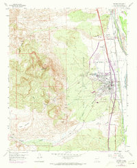
1959 Map of Socorro
USGS Topo · Published 1960About this map
Socorro and the surrounding valley floor are meticulously detailed in this late 1950s survey, showing the town's expansion toward the New Mexico Institute of Mining and Technology. The landscape is defined by the sharp transition between the irrigated valley along the Rio Grande and the high desert terrain of Socorro Peak. An intricate water management system is visible east of town, including the Socorro Main Canal, Riverside Drain, and a Settling Basin near the riverbanks.
Find a feature on this map
35 named features on this map. Tap any name to fly to it.
Don’t see what you’re looking for? This feature index may not catch every label — zoom into the map to look around manually.
Map Details
Editions of this 1959 Socorro Map
2 editions found
Other maps of this area

1906 · Socorro
USGS Topo · 1:62,500

1916 · La Joya
USGS Topo · 1:125,000

1948 · San Antonio
USGS Topo · 1:62,500

1954 · Tularosa
USGS Topo · 1:250,000

1954 · Socorro
USGS Topo · 1:250,000

1958 · Socorro
USGS Topo · 1:250,000

1958 · Tularosa
USGS Topo · 1:250,000

1959 · Loma De Las Canas
USGS Topo · 1:24,000

1959 · Mesa Del Yeso
USGS Topo · 1:24,000

1959 · Lemitar
USGS Topo · 1:24,000