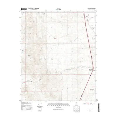
2013 Map of Luis Lopez
USGS Topo · Published 2013About this map
The Chupadera Mountains dominate the western landscape of this Socorro County region, casting a long geological shadow over the Rio Grande valley corridor to the east. Along the modern path of the interstate, the traditional settlements of Luis Lopez and San Antonio maintain their historical positions near the river, connected by the old arterial State Road 1. The map reveals a land divided between the agricultural and residential pockets of San Antonito and the expansive, arid grazing lands to the west. Working cattle operations such as the Jacobo Sedillo Ranch and Nogal Ranch are situated at the transition between the basin floor and the rugged drainage systems of Madera Canyon and Red Canyon. Water management remains a central theme for the area's inhabitants, documented through essential features like Chupadera Spring, Montoya Tank, and the winding course of Walnut Cr.
Find a feature on this map
29 named features on this map. Tap any name to fly to it.
Don’t see what you’re looking for? This feature index may not catch every label — zoom into the map to look around manually.
Map Details
Editions of this 2013 Luis Lopez Map
This is the sole edition of this map. No revisions or reprints were ever made.
Other maps of this area

1906 · Socorro
USGS Topo · 1:62,500

1916 · La Joya
USGS Topo · 1:125,000

1948 · San Antonio
USGS Topo · 1:62,500

1954 · Tularosa
USGS Topo · 1:250,000

1954 · Socorro
USGS Topo · 1:250,000

1958 · Socorro
USGS Topo · 1:250,000

1958 · Tularosa
USGS Topo · 1:250,000

1959 · Loma De Las Canas
USGS Topo · 1:24,000

1959 · Socorro
USGS Topo · 1:24,000

1959 · Magdalena
USGS Topo · 1:62,500