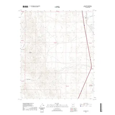
2020 Map of Luis Lopez
USGS Topo · Published 2020About this map
Luis Lopez and San Antonio anchor the eastern corridor of this New Mexico landscape, positioned along the transportation artery that parallels the Rio Grande valley. The terrain transitions sharply from these low-lying settlements toward the west, where the Chupadera Mountains dominate the horizon. This 2020 survey illustrates the contrast between the organized rural road network, including Farm Market RD and San Antonio RD, and the intricate drainage patterns of the high desert. Key natural features like Red Canyon and Madera Canyon carve through the uplands, while vital water points such as Chupadera Spring, Montoya Tank, and Miera Tank are documented across the arid stretches. The map also traces Walnut Creek as it winds toward the valley, providing a detailed look at the geographic relationship between the mountainous Rincon Madera and the settled flats of Socorro County.
Find a feature on this map
25 named features on this map. Tap any name to fly to it.
Don’t see what you’re looking for? This feature index may not catch every label — zoom into the map to look around manually.
Map Details
Editions of this 2020 Luis Lopez Map
This is the sole edition of this map. No revisions or reprints were ever made.
Other maps of this area

1906 · Socorro
USGS Topo · 1:62,500

1916 · La Joya
USGS Topo · 1:125,000

1948 · San Antonio
USGS Topo · 1:62,500

1954 · Tularosa
USGS Topo · 1:250,000

1954 · Socorro
USGS Topo · 1:250,000

1958 · Socorro
USGS Topo · 1:250,000

1958 · Tularosa
USGS Topo · 1:250,000

1959 · Loma De Las Canas
USGS Topo · 1:24,000

1959 · Socorro
USGS Topo · 1:24,000

1959 · Magdalena
USGS Topo · 1:62,500