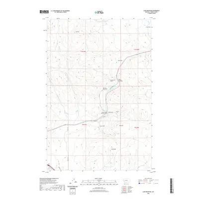
2020 Map of Luke Mountain
USGS Topo · Published 2020About this map
The Little Blackfoot River carves a central path through this section of Powell County, dictating the placement of early transportation infrastructure. Evidence of historical transit is found at the Northern Pacific Railroad Overpass and the Little Blackfoot River Bridge, where the terrain forced a convergence of rail and road. The landscape is defined by a series of named drainages including Homestead Gulch, Dave Gulch, and Shearing Plant Gulch, the latter hinting at the area's agricultural history. Higher elevations are anchored by Luke Mtn in the northwest and the prominent Castle Rock overlooking the river valley. The map details a network of rural routes such as Beck Hill Rd and Choke Cherry Ln that connect these drainages, providing a clear view of how topographic features like Rocky Ridge influenced the local settlement pattern and access to water sources like Gimlet Cr.
Find a feature on this map
27 named features on this map. Tap any name to fly to it.
Don’t see what you’re looking for? This feature index may not catch every label — zoom into the map to look around manually.
Map Details
Editions of this 2020 Luke Mountain Map
This is the sole edition of this map. No revisions or reprints were ever made.
Other maps of this area

1889 · Helena
USGS Topo · 1:250,000

1893 · Helena
USGS Topo · 1:250,000

1899 · Helena
USGS Topo · 1:250,000

1903 · Helena
USGS Topo · 1:250,000

1947 · Butte
USGS Topo · 1:250,000

1958 · Butte
USGS Topo · 1:250,000

1958 · Avon
USGS Topo · 1:62,500

1958 · Garrison
USGS Topo · 1:62,500

1959 · Deer Lodge
USGS Topo · 1:62,500

1960 · Butte
USGS Topo · 1:250,000