
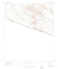
1963 Map of Lukeville
USGS Topo · Published 1964About this map
Organ Pipe Cactus National Monument dominates this desert landscape, where the United States Mexico border defines the southern limit of Pima County. The map captures a transition point between the La Abra Plain and the Puerto Blanco Mts, revealing an economy built on both border commerce and hard-rock mining. At the international line, Lukeville stands adjacent to the U S Customs and Immigration Reserve, while a series of remote mining operations like the Victoria Mine and Baker Mine dot the mountain slopes. Evidence of ranching and early desert survival is found at Dowling Ranch and scattered watering points such as Red Tanks Well and Pozo Salado Well. The rugged infrastructure of the mid-century monument is also visible, including the Puerto Blanco Drive and Monument Headquarters.
Find a feature on this map
41 named features on this map. Tap any name to fly to it.
Don’t see what you’re looking for? This feature index may not catch every label — zoom into the map to look around manually.
Map Details
Editions of this 1963 Lukeville Map
2 editions found
Other maps of this area

1953 · Ajo
USGS Topo · 1:250,000

1954 · Sonoyta
USGS Topo · 1:250,000

1957 · Ajo
USGS Topo · 1:250,000

1958 · Ajo
USGS Topo · 1:250,000

1962 · Ajo
USGS Topo · 1:250,000

1963 · Ajo
USGS Topo · 1:250,000

1963 · Mt. Ajo
USGS Topo · 1:62,500

1963 · Quitobaquito Springs
USGS Topo · 1:62,500

1963 · Kino Peak
USGS Topo · 1:62,500

1963 · Lukeville
USGS Topo · 1:250,000