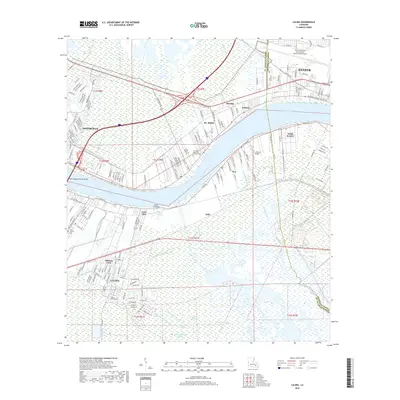
2018 Map of Luling
USGS Topo · Published 2018About this map
The Mississippi River carves a massive crescent through this landscape, defining the industrial and residential corridors of St. Rose, Destrehan, and Luling. This river-bend geography is marked by historic points of interest like the Davis Crevasse, a site of significant nineteenth-century flooding that reshaped the local terrain. The transition from the high-ground river levees to the low-lying wetlands is visible through an intricate network of drainage features such as the Walker Canal, Sellers Canal, and Lanusse Canal. Modern infrastructure dominates the northern and southern banks, anchored by the Louis Armstrong New Orleans International Airport and the sprawling Hale Boggs Memorial Bridge. Local genealogy is preserved in sites like Jefferson Memorial Gardens Cem and Saint Charles Cem, situated among established neighborhoods and the smaller settlements of Ama and South Kenner.
Find a feature on this map
44 named features on this map. Tap any name to fly to it.
Don’t see what you’re looking for? This feature index may not catch every label — zoom into the map to look around manually.
Map Details
Editions of this 2018 Luling Map
This is the sole edition of this map. No revisions or reprints were ever made.
Other maps of this area

1891 · Hahnville
USGS Topo · 1:62,500

1891 · Spanish Fort
USGS Topo · 1:62,500

1891 · New Orleans
USGS Topo · 1:62,500

1892 · Bonnet Carre
USGS Topo · 1:62,500

1932 · New Orleans NW
USGS Topo · 1:31,680

1932 · New Orleans SW
USGS Topo · 1:31,680

1932 · Hahnville NW
USGS Topo · 1:31,680

1932 · Hahnville SW
USGS Topo · 1:31,680

1932 · Hahnville NE
USGS Topo · 1:31,680

1935 · Laplace
USGS Topo · 1:31,680