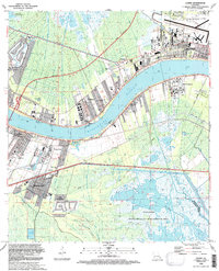
1992 Map of Luling
USGS Topo · Published 1992About this map
The Mississippi River creates a dramatic curve through this St. Charles Parish landscape, separating the communities of Luling, Lone Star, and Mimosa Park on the west bank from Destrehan, St Rose, and Almedia on the east. This industrial and residential corridor is marked by a history of river interaction, most notably the site of the Davis Crevasse (1884), a reminder of the massive levee breach that once reshaped this terrain.
Find a feature on this map
48 named features on this map. Tap any name to fly to it.
Don’t see what you’re looking for? This feature index may not catch every label — zoom into the map to look around manually.
Map Details
Editions of this 1992 Luling Map
This is the sole edition of this map. No revisions or reprints were ever made.
Other maps of this area

1891 · Hahnville
USGS Topo · 1:62,500

1891 · Spanish Fort
USGS Topo · 1:62,500

1891 · New Orleans
USGS Topo · 1:62,500

1892 · Bonnet Carre
USGS Topo · 1:62,500

1932 · New Orleans NW
USGS Topo · 1:31,680

1932 · New Orleans SW
USGS Topo · 1:31,680

1932 · Hahnville NW
USGS Topo · 1:31,680

1932 · Hahnville SW
USGS Topo · 1:31,680

1932 · Hahnville NE
USGS Topo · 1:31,680

1935 · Laplace
USGS Topo · 1:31,680