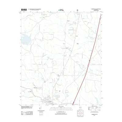
2012 Map of Lumberton
USGS Topo · Published 2012About this map
Lumberton anchors this region of southern Mississippi, where the grid-like streets of the town give way to a network of rural roads and creek drainages. The landscape is defined by the winding paths of Little Black Creek and Red Creek, which dictate the placement of early settlements like Talowah and Wells Town. Genealogists and local historians will find significant value in the numerous burial sites identified across the township, including Samuel Slade Cemetery, Slade Cemetery, and the Corinth Cemetery near the northern boundary. Transportation and infrastructure are highlighted by the presence of Freedom Strip Airport and the I H Bass Jr Memorial Airport, while place names like Boggy Hollow and Carters Reed Brake offer insight into the local wetlands and topography.
Find a feature on this map
86 named features on this map. Tap any name to fly to it.
Don’t see what you’re looking for? This feature index may not catch every label — zoom into the map to look around manually.
Map Details
Editions of this 2012 Lumberton Map
This is the sole edition of this map. No revisions or reprints were ever made.
Other maps of this area

1953 · Hattiesburg
USGS Topo · 1:250,000

1953 · Mobile
USGS Topo · 1:250,000

1957 · Mobile
USGS Topo · 1:250,000

1958 · Hattiesburg
USGS Topo · 1:250,000

1958 · Carnes
USGS Topo · 1:62,500

1959 · Poplarville
USGS Topo · 1:62,500

1960 · Mobile
USGS Topo · 1:250,000

1963 · Mobile
USGS Topo · 1:250,000

1963 · Rock Hill
USGS Topo · 1:24,000

1964 · Purvis
USGS Topo · 1:24,000