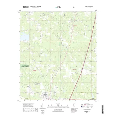
2018 Map of Lumberton
USGS Topo · Published 2018About this map
Purvis and Lumberton anchor this south-central Mississippi landscape, where a dense network of country roads connects family settlements and historic burial grounds during the late 2010s. The region is defined by the winding paths of Little Black Cr and Red Cr, as well as the unique marshy expanse of Gordons Reed Brake. Rural life is centered around small communities like Talowah and Seneca, while the BNSF Railway provides a industrial artery through the timbered terrain. Several small family and community cemeteries, including Seneca Cem, Union Grove Cem, and the Samuel Slade Cem, offer valuable touchpoints for genealogists tracing the local population. To the southwest, the I H Bass Jr Memorial Airport stands as a prominent modern landmark near the Pearl River Co boundary.
Find a feature on this map
102 named features on this map. Tap any name to fly to it.
Don’t see what you’re looking for? This feature index may not catch every label — zoom into the map to look around manually.
Map Details
Editions of this 2018 Lumberton Map
This is the sole edition of this map. No revisions or reprints were ever made.
Other maps of this area

1953 · Hattiesburg
USGS Topo · 1:250,000

1953 · Mobile
USGS Topo · 1:250,000

1957 · Mobile
USGS Topo · 1:250,000

1958 · Hattiesburg
USGS Topo · 1:250,000

1958 · Carnes
USGS Topo · 1:62,500

1959 · Poplarville
USGS Topo · 1:62,500

1960 · Mobile
USGS Topo · 1:250,000

1963 · Mobile
USGS Topo · 1:250,000

1963 · Rock Hill
USGS Topo · 1:24,000

1964 · Purvis
USGS Topo · 1:24,000