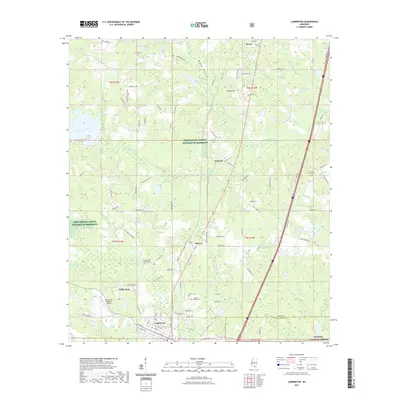
2021 Map of Lumberton
USGS Topo · Published 2021About this map
The town of Lumberton anchor this region of southern Mississippi, situated where the borders of Lamar and Pearl River counties meet. This modern survey illustrates a landscape defined by managed timberlands and rural communities, including Talowah, Seneca, and Wells Town. Extensive tracts designated as Farm Service Agency Interest of Mississippi and portions of the De Soto National Forest dominate the southern and western portions of the quadrangle. Genealogists will find a high concentration of family-named burial sites, such as the Slade Cemetery and Samuel Slade Cemetery, alongside community landmarks like the I H Bass Jr Memorial Airport. The terrain is characterized by a network of small drainages including Little Black Creek and Beaverdam Branch, which have historically shaped the settlement patterns and local road networks like Old Hwy 11.
Find a feature on this map
101 named features on this map. Tap any name to fly to it.
Don’t see what you’re looking for? This feature index may not catch every label — zoom into the map to look around manually.
Map Details
Editions of this 2021 Lumberton Map
This is the sole edition of this map. No revisions or reprints were ever made.
Other maps of this area

1953 · Hattiesburg
USGS Topo · 1:250,000

1953 · Mobile
USGS Topo · 1:250,000

1957 · Mobile
USGS Topo · 1:250,000

1958 · Hattiesburg
USGS Topo · 1:250,000

1958 · Carnes
USGS Topo · 1:62,500

1959 · Poplarville
USGS Topo · 1:62,500

1960 · Mobile
USGS Topo · 1:250,000

1963 · Mobile
USGS Topo · 1:250,000

1963 · Rock Hill
USGS Topo · 1:24,000

1964 · Purvis
USGS Topo · 1:24,000