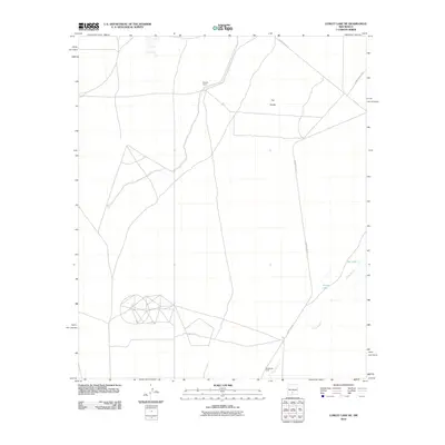
2010 Map of Lumley Lake NE
USGS Topo · Published 2010About this map
Malpais Camp and MacDonald Camp anchor this arid high-desert landscape in Otero County, where sparse human infrastructure meets the edge of the Tularosa Basin. The geography is defined by the ephemeral drainage of Three Rivers, which winds through the southeastern portion of the quadrangle toward the broad expanse of The Sands. This 2010 survey illustrates the remote network of specialized access roads, including WSMR P Route 17 and WSMR P Route 9, which serve the highly regulated interior of the White Sands Missile Range. Small water features such as Turner Lake and Big Tank provide the only breaks in the desert terrain, reflecting the area's history as a site for controlled scientific and military operations rather than traditional residential development.
Find a feature on this map
9 named features on this map. Tap any name to fly to it.
Don’t see what you’re looking for? This feature index may not catch every label — zoom into the map to look around manually.
Map Details
Editions of this 2010 Lumley Lake NE Map
This is the sole edition of this map. No revisions or reprints were ever made.
Other maps of this area

1916 · Tularosa
USGS Topo · 1:125,000

1947 · Three Rivers
USGS Topo · 1:62,500

1947 · Capitol Peak
USGS Topo · 1:62,500

1948 · Lumley Lake
USGS Topo · 1:62,500

1948 · Tularosa
USGS Topo · 1:62,500

1954 · Tularosa
USGS Topo · 1:250,000

1958 · Tularosa
USGS Topo · 1:250,000

1981 · Tularosa
USGS Topo · 1:100,000
1981 · Three Rivers SW
USGS Topo · 1:24,000
1981 · Sheep Mountain
USGS Topo · 1:24,000