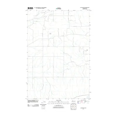
2011 Map of Luna Butte
USGS Topo · Published 2011About this map
Luna Butte rises as a prominent landmark in this section of Klickitat County, overlooking a landscape defined by agricultural road networks and watercourses like the Little Klickitat River and Swole Creek. The area's transit infrastructure is dominated by the Bickleton Hwy, which connects various family-named rural routes such as Chambers Rd, Bigby Rd, and Willis Rd. This 2011 survey captures the region's aviation and ranching character, centered around the Hillcrest Airport and the expansive tracts between Munson Prairie Rd and the North Luna Creek drainage. The map reveals the placement of water resources essential to the local economy, including Harper Spring, set against a backdrop of named gulches and high valley roads that trace the contours of the Washington terrain.
Find a feature on this map
38 named features on this map. Tap any name to fly to it.
Don’t see what you’re looking for? This feature index may not catch every label — zoom into the map to look around manually.
Map Details
Editions of this 2011 Luna Butte Map
This is the sole edition of this map. No revisions or reprints were ever made.
Other maps of this area

1953 · The Dalles
USGS Topo · 1:250,000

1956 · The Dalles
USGS Topo · 1:250,000

1957 · The Dalles
USGS Topo · 1:250,000

1957 · Wasco
USGS Topo · 1:62,500

1957 · Goldendale
USGS Topo · 1:62,500

1957 · Wishram
USGS Topo · 1:62,500

1957 · Satus Pass
USGS Topo · 1:62,500

1971 · Quinton
USGS Topo · 1:24,000

1971 · Rufus
USGS Topo · 1:24,000
1977 · Biggs Junction
USGS Topo · 1:24,000