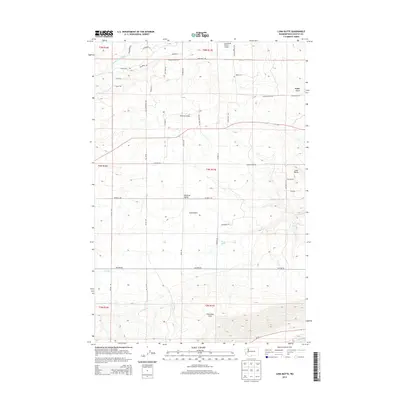
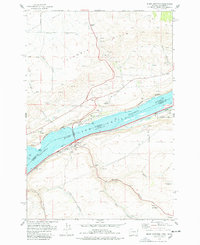
2013 Map of Luna Butte
USGS Topo · Published 2013About this map
The Columbia Hills and the broad Klickitat Valley define this landscape in Klickitat County, where the terrain drops from the northern ridges down toward the plateau south of the Little Klickitat River. The area is marked by a network of ranch and farm roads like Hoctor RD and Number 4 RD, reflecting a rural economy centered on large land holdings and aviation, as seen at the Aerostone Ranch Airport and Hillcrest Airport. Natural drainage patterns are etched into the earth by Luna Gulch and Badger Gulch, while Harper Spring provides a critical water source in this dry upland environment. Local landmarks like Luna Butte stand out against the agricultural grid of the Public Land Survey System, which remains the primary organizing structure for the scattered homesteads and properties throughout the quadrangle.
Find a feature on this map
84 named features on this map. Tap any name to fly to it.
Don’t see what you’re looking for? This feature index may not catch every label — zoom into the map to look around manually.
Map Details
Editions of this 2013 Luna Butte Map
This is the sole edition of this map. No revisions or reprints were ever made.
Other maps of this area

1953 · The Dalles
USGS Topo · 1:250,000

1956 · The Dalles
USGS Topo · 1:250,000
1957 · The Dalles
USGS Topo · 1:250,000
1957 · Wasco
USGS Topo · 1:62,500
1957 · Goldendale
USGS Topo · 1:62,500
1957 · Wishram
USGS Topo · 1:62,500
1957 · Satus Pass
USGS Topo · 1:62,500
1971 · Quinton
USGS Topo · 1:24,000
1971 · Rufus
USGS Topo · 1:24,000
1977 · Biggs Junction
USGS Topo · 1:24,000