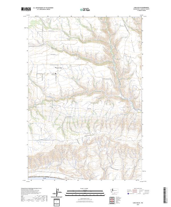
2023 Map of Luna Gulch
USGS Topo · Published 2023About this map
Pleasant Valley and the rural heights of Klickitat County are mapped here in detail, showing a landscape defined by deep drainages and ridges. In the northern section, the Pleasant Valley Cem sits near the junction of Oak Flat Rd and Goldendale Bickleton Rd, serving as a central point for the surrounding homesteads and ranches. The terrain is deeply incised by Badger Gulch and Luna Gulch, which channel water toward the southern boundary.
Find a feature on this map
34 named features on this map. Tap any name to fly to it.
Don’t see what you’re looking for? This feature index may not catch every label — zoom into the map to look around manually.
Map Details
Editions of this 2023 Luna Gulch Map
This is the sole edition of this map. No revisions or reprints were ever made.
Other maps of this area

1916 · Arlington
USGS Topo · 1:125,000

1953 · The Dalles
USGS Topo · 1:250,000

1956 · The Dalles
USGS Topo · 1:250,000

1957 · The Dalles
USGS Topo · 1:250,000

1957 · Wasco
USGS Topo · 1:62,500

1957 · Satus Pass
USGS Topo · 1:62,500

1965 · Goodnoe Hills
USGS Topo · 1:24,000
1965 · Bickleton NW
USGS Topo · 1:24,000

1971 · Quinton
USGS Topo · 1:24,000
1971 · Sundale NW
USGS Topo · 1:24,000