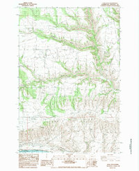
1983 Map of Luna Gulch
USGS Topo · Published 1983About this map
The Columbia River and Lake Umatilla define the southern edge of this Klickitat County landscape, where the settlement of Towal sits along the riverbank. Moving north from the water, the terrain rises sharply into the Goodnoe Hills and across Oak Flat, eventually giving way to the high-elevation open spaces of Pleasant Valley. This 1983 provisional survey highlights a transition from traditional land uses to industrial infrastructure, with a dense network of transmission lines—including Three Steel Tower Transmission Lines—crossing the hills to harness the region's energy potential.
Find a feature on this map
23 named features on this map. Tap any name to fly to it.
Don’t see what you’re looking for? This feature index may not catch every label — zoom into the map to look around manually.
Map Details
Editions of this 1983 Luna Gulch Map
This is the sole edition of this map. No revisions or reprints were ever made.
Other maps of this area

1916 · Arlington
USGS Topo · 1:125,000

1953 · The Dalles
USGS Topo · 1:250,000

1956 · The Dalles
USGS Topo · 1:250,000

1957 · The Dalles
USGS Topo · 1:250,000

1957 · Wasco
USGS Topo · 1:62,500

1957 · Satus Pass
USGS Topo · 1:62,500

1965 · Goodnoe Hills
USGS Topo · 1:24,000
1965 · Bickleton NW
USGS Topo · 1:24,000

1971 · Quinton
USGS Topo · 1:24,000
1971 · Sundale NW
USGS Topo · 1:24,000