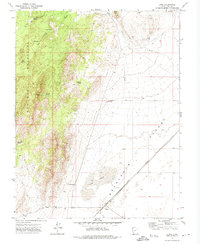
1971 Map of Lund
USGS Topo · Published 1974About this map
Lund stands as a lonely outpost at the edge of the Escalante Desert, where the Union Pacific railroad line cuts a straight path across the arid basin. This 1971 survey captures the town surrounded by the vast Lund Flats, a landscape defined by its reliance on scarce water sources. The map documents numerous vital watering points, from the Lyman Well to the high-elevation Marsden Spring, which supported livestock and early travelers in this remote corner of Iron County. To the west, the topography rises sharply into the Wah Wah Mountains, a stark contrast to the desert floor. Here, a network of Jeep Trails and primitive roads like Valley Road link isolated sites such as the Sulphur Spring and a small Prospect to the north, reflecting the region's history of mineral exploration and ranching.
Find a feature on this map
34 named features on this map. Tap any name to fly to it.
Don’t see what you’re looking for? This feature index may not catch every label — zoom into the map to look around manually.
Map Details
Editions of this 1971 Lund Map
This is the sole edition of this map. No revisions or reprints were ever made.
Other maps of this area

1885 · St. George
USGS Topo · 1:250,000

1891 · St. George
USGS Topo · 1:250,000

1951 · Avon
USGS Topo · 1:24,000

1951 · Avon NW
USGS Topo · 1:24,000

1953 · Richfield
USGS Topo · 1:250,000

1953 · Cedar City
USGS Topo · 1:250,000

1958 · Richfield
USGS Topo · 1:250,000

1958 · Cedar City
USGS Topo · 1:250,000

1962 · Cedar City
USGS Topo · 1:250,000
1971 · Burns Knoll
USGS Topo · 1:24,000