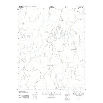
2011 Map of Lurton
USGS Topo · Published 2011About this map
Lurton and Spence Junction anchor this high-elevation corner of the Arkansas Ozarks as it appeared in the early 21st century. The landscape is defined by its deep drainages and prominent peaks, including the sheer bluff of Sams Throne and the isolated height of Sassafras Knob. These geological features dictate the winding paths of rural routes like Co RD 299 and Lurton Ag RD, which navigate the steep descents into Greenhaw Hollow and Still Hollow. Local history is preserved in the small burial grounds of Tarlton Cemetery, Richland Cemetery, and Cox Hollow, often situated near the headwaters of the region's many branches and creeks. A network of waterways, including Big Creek and Richland Creek, carves through the terrain, illustrating the remote and fragmented settlement pattern of the Boston Mountains. The Ketcherside Fire Tower stands on a high ridge to the east, overlooking the confluence of Falls Branch and Cave Creek.
Find a feature on this map
37 named features on this map. Tap any name to fly to it.
Don’t see what you’re looking for? This feature index may not catch every label — zoom into the map to look around manually.
Map Details
Editions of this 2011 Lurton Map
This is the sole edition of this map. No revisions or reprints were ever made.
Other maps of this area

1879 · Washington
USGS Topo · 1:62,500

1887 · Smyrna
USGS Topo · 1:62,500

1889 · Treat
USGS Topo · 1:62,500

1889 · Marshall #3
USGS Topo · 1:62,500

1892 · Marshall
USGS Topo · 1:125,000

1894 · Marshall
USGS Topo · 1:125,000

1901 · Marshall
USGS Topo · 1:125,000

1932 · Treat
USGS Topo · 1:62,500

1933 · Mt Judea
USGS Topo · 1:62,500

1934 · Treat
USGS Topo · 1:62,500