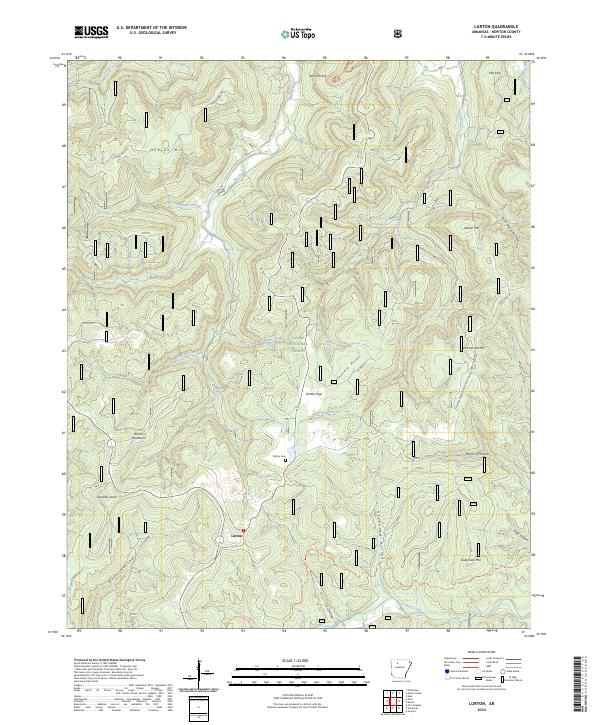
2024 Map of Lurton
USGS Topo · Published 2024About this map
Lurton sits as a central settlement within the high elevations of the Boston Mountains, surrounded by the protected lands of the Ozark National Forest. This modern mapping of the Arkansas highlands illustrates a landscape defined by sharp topographical changes, where ridges like Hudson Mtn and Ketcherside Mtn separate deep hollows and creek beds. The drainage patterns of Big Creek and Richland Creek dictate the local geography, with the latter designated as the Richland Creek Wild and Scenic River. Evidence of local heritage is found at the Tarlton Cem and along Lurton Assemblies of God Church Rd, while recreational landmarks such as Sams Throne and the Ozark Highlands Tr highlight the area's importance for backcountry navigation. The map provides a detailed view of the Richland Creek Wilderness, showing how the rugged terrain of Tarlton Flats and Sassafas Knob remains largely undeveloped.
Find a feature on this map
48 named features on this map. Tap any name to fly to it.
Don’t see what you’re looking for? This feature index may not catch every label — zoom into the map to look around manually.
Map Details
Editions of this 2024 Lurton Map
This is the sole edition of this map. No revisions or reprints were ever made.
Other maps of this area

1879 · Washington
USGS Topo · 1:62,500

1887 · Smyrna
USGS Topo · 1:62,500

1889 · Treat
USGS Topo · 1:62,500

1889 · Marshall #3
USGS Topo · 1:62,500

1892 · Marshall
USGS Topo · 1:125,000

1894 · Marshall
USGS Topo · 1:125,000

1901 · Marshall
USGS Topo · 1:125,000

1932 · Treat
USGS Topo · 1:62,500

1933 · Mt Judea
USGS Topo · 1:62,500

1934 · Treat
USGS Topo · 1:62,500