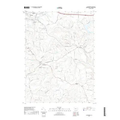
2019 Map of Luthersburg
USGS Topo · Published 2019About this map
Luthersburg and the surrounding townships of southern Clearfield County are documented here, showing a landscape defined by both its natural hydrology and industrial geography. The transition from the more developed area of Oklahoma and southern Dubois into the higher elevations of Coal Hill and Laurel Ridge illustrates the rural character of the region. Local history is deeply embedded in the terrain, with numerous community anchors such as the Saint Lukes United Church of Christ Cem and the Salem Methodist Cem serving as landmarks for genealogists. The map also highlights the importance of water management for the region, featuring the Du Bois Reservoir and the complex drainage of Anderson Creek and Sandy Lick Cr. Smaller settlements like Rockton and Chestnut Grove remain connected by a network of winding roads, including the Old Pike Rd, tracing the early paths of commerce through the Pennsylvania hills.
Find a feature on this map
110 named features on this map. Tap any name to fly to it.
Don’t see what you’re looking for? This feature index may not catch every label — zoom into the map to look around manually.
Map Details
Editions of this 2019 Luthersburg Map
This is the sole edition of this map. No revisions or reprints were ever made.
Other maps of this area

1903 · Curwensville
USGS Topo · 1:62,500

1906 · Punxsutawney
USGS Topo · 1:62,500

1922 · Du Bois
USGS Topo · 1:62,500

1924 · Du Bois
USGS Topo · 1:62,500

1929 · Penfield
USGS Topo · 1:62,500

1932 · Penfield
USGS Topo · 1:62,500

1939 · Curwensville
USGS Topo · 1:62,500

1939 · Punxsutawney
USGS Topo · 1:62,500

1942 · Curwensville
USGS Topo · 1:62,500

1942 · Punxsutawney
USGS Topo · 1:62,500