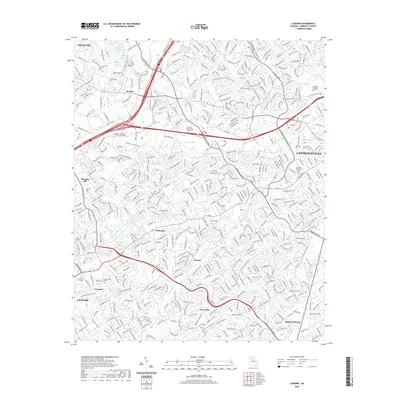
2020 Map of Luxomni
USGS Topo · Published 2020About this map
The Yellow River and its numerous tributaries, including Sweetwater Cr and Beaver Ruin Cr, anchor this suburban landscape as it appeared in the late 2010s. The area is defined by a dense residential and commercial network stretching between Duluth and Lawrenceville, with the historic community of Luxomni situated near the headwaters of Jackson Cr. The map captures a period of significant institutional presence, showing the sprawling campuses of Georgia Gwinnett College, Gwinnett Technical College, and the Atlanta Institute of Music and Media. Local history is preserved in landmarks such as Ford Cem and the older crossroads at Five Forks and Gloster. The drainage patterns, represented by many small impoundments like Lake Matthews and Sturdivant Lake, reveal how the natural hydrology has been integrated into the modern development of Gwinnett County.
Find a feature on this map
44 named features on this map. Tap any name to fly to it.
Don’t see what you’re looking for? This feature index may not catch every label — zoom into the map to look around manually.
Map Details
Editions of this 2020 Luxomni Map
This is the sole edition of this map. No revisions or reprints were ever made.
Other maps of this area

1888 · Atlanta
USGS Topo · 1:125,000

1890 · Suwanee
USGS Topo · 1:125,000

1890 · Atlanta
USGS Topo · 1:125,000

1891 · Gainesville
USGS Topo · 1:125,000

1892 · Atlanta
USGS Topo · 1:125,000

1894 · Suwanee
USGS Topo · 1:125,000

1895 · Atlanta
USGS Topo · 1:125,000

1896 · Monroe
USGS Topo · 1:125,000

1953 · Atlanta
USGS Topo · 1:250,000

1953 · Athens
USGS Topo · 1:250,000