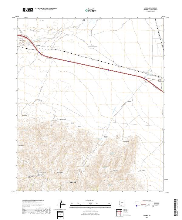
2021 Map of Luzena
USGS Topo · Published 2021About this map
Luzena serves as the focal point for this high-desert landscape in Cochise County, where the northern flats give way to the complex drainage systems of the southern mountains. The terrain is defined by a dense network of canyons and gulches, including Walnut Gulch and Gold Gulch, which feed into the wider Railroad Wash. To the south, the topography rises sharply toward Maverick Mtn and Rough Mtn, featuring a variety of seasonal water sources such as Riley Spring and the curiously named Cowboy Swimming Hole. Historical land use is evidenced by the presence of Buckeye Mill, situated in the shadow of the peaks near Buckeye Canyon. The map reveals a transition from the structured ranch road system in the north, including W Luzena Rd and Page Ranch Rd, to the more winding trails and isolated springs that characterize the higher elevations of the Dos Cabezas Mountains range.
Find a feature on this map
49 named features on this map. Tap any name to fly to it.
Don’t see what you’re looking for? This feature index may not catch every label — zoom into the map to look around manually.
Map Details
Editions of this 2021 Luzena Map
This is the sole edition of this map. No revisions or reprints were ever made.
Other maps of this area

1917 · San Simon
USGS Topo · 1:125,000

1922 · Willcox
USGS Topo · 1:125,000

1926 · Cochise Head
USGS Topo · 1:62,500

1928 · Bowie
USGS Topo · 1:62,500

1943 · Dos Cabezas
USGS Topo · 1:62,500

1944 · Fisher Hills
USGS Topo · 1:62,500

1949 · Bowie
USGS Topo · 1:62,500

1950 · Bowie
USGS Topo · 1:62,500

1950 · Cochise Head
USGS Topo · 1:62,500

1954 · Silver City
USGS Topo · 1:250,000