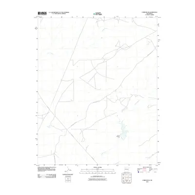
2010 Map of Lybrook SE
USGS Topo · Published 2010About this map
The high desert drainage of Cañada Alemita defines this 2010 landscape within the Eastern Navajo Agency of New Mexico. The geography is characterized by seasonal watercourses and essential water infrastructure, notably the Alamos Detention Dam and the localized Ojo Sandoval Spring. The presence of these features suggests a land management strategy focused on capturing intermittent runoff in an arid environment. Transportation and industrial activity are evidenced by the intersection of Indian Service Rte 46 and Pipeline Rd, which cut across the plateaus and arroyos. This infrastructure connects the open spaces of Cañada Alamos to broader regional routes, serving both tribal transit and utility maintenance in the early 21st century.
Find a feature on this map
6 named features on this map. Tap any name to fly to it.
Don’t see what you’re looking for? This feature index may not catch every label — zoom into the map to look around manually.
Map Details
Editions of this 2010 Lybrook SE Map
This is the sole edition of this map. No revisions or reprints were ever made.
Other maps of this area

1883 · Mt. Taylor
USGS Topo · 1:250,000

1886 · Mt. Taylor
USGS Topo · 1:250,000

1889 · Largo
USGS Topo · 1:250,000

1892 · Mt. Taylor
USGS Topo · 1:250,000

1895 · Largo
USGS Topo · 1:250,000

1899 · Mt. Taylor
USGS Topo · 1:250,000

1954 · Aztec
USGS Topo · 1:250,000

1958 · Aztec
USGS Topo · 1:250,000

1958 · Albuquerque
USGS Topo · 1:250,000

1960 · Pueblo Alto Trading Post
USGS Topo · 1:24,000