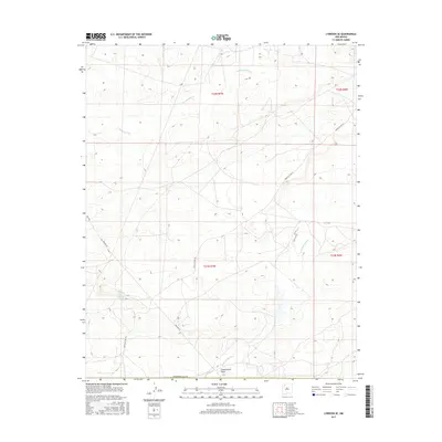
2017 Map of Lybrook SE
USGS Topo · Published 2017About this map
Cottonwood Flats defines the southern landscape of this Sandoval County terrain, where intermittent drainage patterns and seasonal water sources have long shaped human activity. The map reveals a network of high-desert infrastructure, specifically the Pipeline Rd and Indian Svc Rte 46, which facilitate movement through the arid plateaus. Natural water features like Ojo Sandoval Spring and Ojo Socorro highlight the vital locations where water reaches the surface in this environment. The topography is deeply incised by significant washes, including Cañada Alemita in the north and Cañada Alamos in the south, illustrating the erosion-carved character of the region. This 2017 survey details the precise township and range boundaries that grid the area, providing a modern record of the landscape's management and its essential hydrological markers.
Find a feature on this map
13 named features on this map. Tap any name to fly to it.
Don’t see what you’re looking for? This feature index may not catch every label — zoom into the map to look around manually.
Map Details
Editions of this 2017 Lybrook SE Map
This is the sole edition of this map. No revisions or reprints were ever made.
Other maps of this area

1883 · Mt. Taylor
USGS Topo · 1:250,000

1886 · Mt. Taylor
USGS Topo · 1:250,000

1889 · Largo
USGS Topo · 1:250,000

1892 · Mt. Taylor
USGS Topo · 1:250,000

1895 · Largo
USGS Topo · 1:250,000

1899 · Mt. Taylor
USGS Topo · 1:250,000

1954 · Aztec
USGS Topo · 1:250,000

1958 · Aztec
USGS Topo · 1:250,000

1958 · Albuquerque
USGS Topo · 1:250,000

1960 · Pueblo Alto Trading Post
USGS Topo · 1:24,000