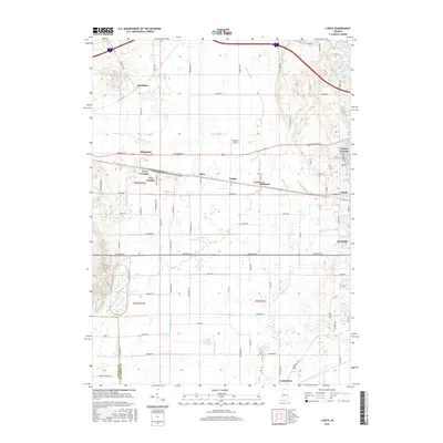
2016 Map of Lydick
USGS Topo · Published 2016About this map
New Carlisle and the surrounding townships in northwestern Saint Joseph County reveal a landscape heavily shaped by intricate drainage systems and agricultural expansion. The township lines of t38n r1w and t38n r1e meeting near the settlement of Zeigler define the local geography, while the water network is dominated by engineered waterways like Geyer Ditch, Laskowski Ditch, and Chain-O-Lakes Ditch. These artificial channels run alongside natural features such as Lost Lake and Mud Lake, illustrating the transition from wetlands to productive farmland.
Find a feature on this map
49 named features on this map. Tap any name to fly to it.
Don’t see what you’re looking for? This feature index may not catch every label — zoom into the map to look around manually.
Map Details
Editions of this 2016 Lydick Map
This is the sole edition of this map. No revisions or reprints were ever made.
Other maps of this area

1927 · Niles
USGS Topo · 1:62,500

1930 · Three Oaks
USGS Topo · 1:62,500

1930 · Niles
USGS Topo · 1:62,500

1943 · Niles
USGS Topo · 1:62,500

1944 · Three Oaks
USGS Topo · 1:62,500

1953 · Chicago
USGS Topo · 1:250,000

1957 · Chicago
USGS Topo · 1:250,000

1958 · South Bend West
USGS Topo · 1:24,000

1958 · Lydick
USGS Topo · 1:24,000

1958 · Stillwell
USGS Topo · 1:24,000