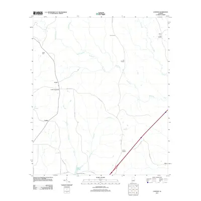
2011 Map of Lyeffion
USGS Topo · Published 2011About this map
Lyeffion and the surrounding rural communities of Grace and Bowles define this southern Alabama landscape as it appeared in the early 21st century. The geography is dominated by the confluence of the West Sepulga River and East Sepulga River, which merge into the Sepulga River to wind southward through a network of creeks and wetlands. Numerous family and community landmarks are scattered across the terrain, including Joyner Cemetery, Mount Olive West Cemetery, and Little Pine Level Cemetery, providing vital touchstones for local genealogical research. In the southern portion of the quadrangle, the water-rich environment is marked by Conecuh County Lake and Lake Shirley, while the Sepulga Lookout Tower stands as a prominent man-made landmark near the river's upper reaches. The local road system, including County Hwy-30 and Cooks Crossroads, reflects the established settlement patterns of this agricultural and timber region.
Find a feature on this map
29 named features on this map. Tap any name to fly to it.
Don’t see what you’re looking for? This feature index may not catch every label — zoom into the map to look around manually.
Map Details
Editions of this 2011 Lyeffion Map
This is the sole edition of this map. No revisions or reprints were ever made.
Other maps of this area

1953 · Andalusia
USGS Topo · 1:250,000

1957 · Andalusia
USGS Topo · 1:250,000

1971 · Lyeffion
USGS Topo · 1:24,000

1971 · Belleville
USGS Topo · 1:24,000

1971 · Garland
USGS Topo · 1:24,000

1971 · Skinnerton
USGS Topo · 1:24,000

1971 · China
USGS Topo · 1:24,000

1971 · Bethel
USGS Topo · 1:24,000

1971 · Georgiana West
USGS Topo · 1:24,000

1982 · Evergreen
USGS Topo · 1:24,000