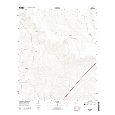
2014 Map of Lyeffion
USGS Topo · Published 2014About this map
Lyeffion and Cooks Crossroads anchor this rural landscape in the southern interior of Alabama, where the border of Butler and Conecuh counties follows the meandering path of Duck Creek. The geography is defined by the convergence of the West and East branches into the main Sepulga River, a waterway that snakes southward through a series of low ridges and valleys. Small family and community landmarks are scattered throughout the quadrangle, including the Second Mt Zion and Little Pine Level cemeteries, indicating long-standing settlement patterns. In the northeast near Grace, the Mt Olive West Cemetery sits near Hank Williams Road, while the southern reaches feature Lake Shirley and the junction of Middle Road and CR-40.
Find a feature on this map
33 named features on this map. Tap any name to fly to it.
Don’t see what you’re looking for? This feature index may not catch every label — zoom into the map to look around manually.
Map Details
Editions of this 2014 Lyeffion Map
This is the sole edition of this map. No revisions or reprints were ever made.
Other maps of this area

1953 · Andalusia
USGS Topo · 1:250,000

1957 · Andalusia
USGS Topo · 1:250,000

1971 · Lyeffion
USGS Topo · 1:24,000

1971 · Belleville
USGS Topo · 1:24,000

1971 · Garland
USGS Topo · 1:24,000

1971 · Skinnerton
USGS Topo · 1:24,000

1971 · China
USGS Topo · 1:24,000

1971 · Bethel
USGS Topo · 1:24,000

1971 · Georgiana West
USGS Topo · 1:24,000

1982 · Evergreen
USGS Topo · 1:24,000