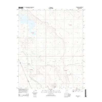
2014 Map of Lyman Lake
USGS Topo · Published 2014About this map
Lyman Lake serves as the focal point of this high-plateau landscape, where the waters of the Little Colorado River are impounded within the township lines of T11N R28E. To the south, the small community of Richville sits at the junction of Us-180 and local routes like CR-4162, positioned near the confluence of Vigil Run and the main river channel. The topography is defined by seasonal drainages and local landmarks such as Scraper Knoll and Neilson Spring, which provide essential water sources in this arid region of eastern Arizona. The map's grid system illustrates the ranching and agricultural framework of the era, with Coyote Cr and Carnero Cr cutting through the terrain to feed into the river valley. This document provides a clear view of the water management and transportation corridors essential to the habitation of the Apache County highlands.
Find a feature on this map
16 named features on this map. Tap any name to fly to it.
Don’t see what you’re looking for? This feature index may not catch every label — zoom into the map to look around manually.
Map Details
Editions of this 2014 Lyman Lake Map
This is the sole edition of this map. No revisions or reprints were ever made.
Other maps of this area

1886 · St Johns
USGS Topo · 1:250,000

1892 · St Johns
USGS Topo · 1:250,000

1954 · Saint Johns
USGS Topo · 1:250,000

1957 · Saint Johns
USGS Topo · 1:250,000

1958 · Saint Johns
USGS Topo · 1:250,000

1962 · Saint Johns
USGS Topo · 1:250,000

1968 · Springerville NW
USGS Topo · 1:24,000

1969 · Coyote Hills
USGS Topo · 1:24,000
1969 · Springerville
USGS Topo · 1:24,000

1971 · Mesa Parada NW
USGS Topo · 1:24,000