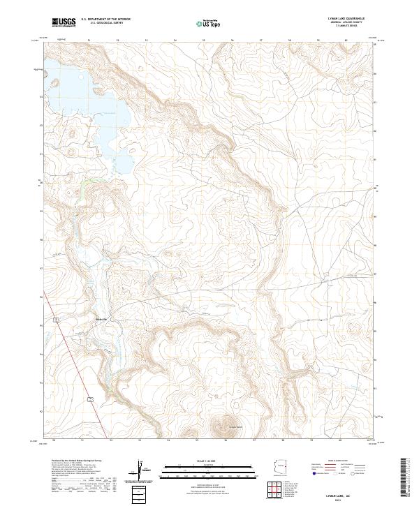
2021 Map of Lyman Lake
USGS Topo · Published 2021About this map
Lyman Lake serves as a central anchor for this high-desert landscape in Apache County, formed by the impoundment of the Little Colorado River. The surrounding terrain is defined by its drainage systems, including the seasonal flows of Coyote Cr, Carnero Cr, and Vigil Run. The small settlement of Richville is situated west of the river, where the valley floor begins its ascent toward prominent landmarks like Scraper Knoll. This modern topographic study illustrates the connectivity provided by local routes such as Co RD 4162 and Co RD 6412, which traverse the high plateaus and creek beds. Reliable water sources in this arid environment are highlighted by the presence of Neilson Spring, illustrating the fundamental role that hydrology plays in determining human activity and settlement patterns in this part of Arizona.
Find a feature on this map
17 named features on this map. Tap any name to fly to it.
Don’t see what you’re looking for? This feature index may not catch every label — zoom into the map to look around manually.
Map Details
Editions of this 2021 Lyman Lake Map
This is the sole edition of this map. No revisions or reprints were ever made.
Other maps of this area

1886 · St Johns
USGS Topo · 1:250,000

1892 · St Johns
USGS Topo · 1:250,000

1954 · Saint Johns
USGS Topo · 1:250,000

1957 · Saint Johns
USGS Topo · 1:250,000

1958 · Saint Johns
USGS Topo · 1:250,000

1962 · Saint Johns
USGS Topo · 1:250,000

1968 · Springerville NW
USGS Topo · 1:24,000

1969 · Coyote Hills
USGS Topo · 1:24,000
1969 · Springerville
USGS Topo · 1:24,000

1971 · Mesa Parada NW
USGS Topo · 1:24,000