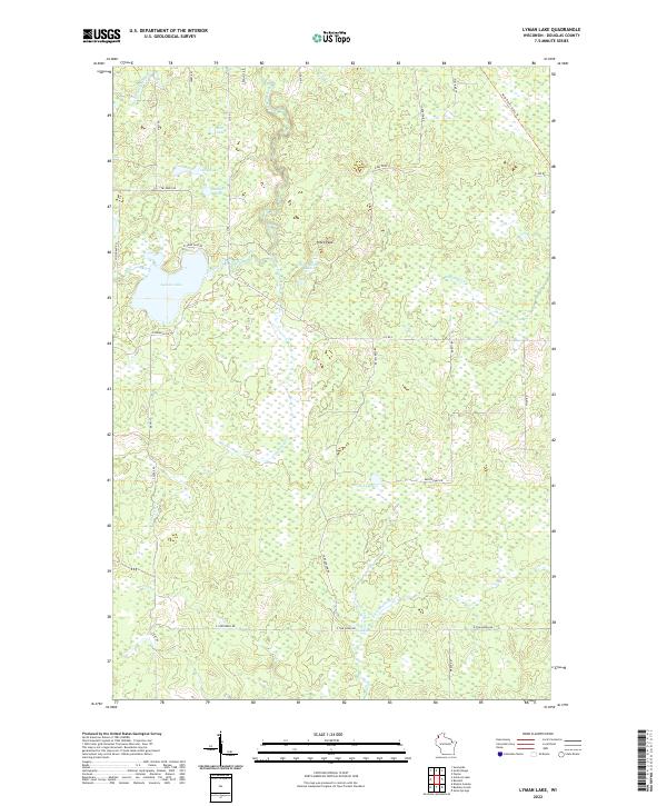
2022 Map of Lyman Lake
USGS Topo · Published 2022About this map
Lyman Lake and its surrounding wetlands define this Douglas County landscape, where the headwaters of several major northern Wisconsin drainage systems originate. The terrain is a network of small glacial lakes and meandering watercourses, including the Little Amnicon River and Amnicon River flowing northward, while the Moose River and E Fork Moose River drain toward the south. Prominent elevations such as Pikes Peak and Pikes Peak S rise above the low-lying marshlands and thickets that dominate much of the area.
Find a feature on this map
41 named features on this map. Tap any name to fly to it.
Don’t see what you’re looking for? This feature index may not catch every label — zoom into the map to look around manually.
Map Details
Editions of this 2022 Lyman Lake Map
This is the sole edition of this map. No revisions or reprints were ever made.
Other maps of this area

1915 · Superior
USGS Topo · 1:48,000

1917 · Superior
USGS Topo · 1:62,500

1945 · Solon Springs
USGS Topo · 1:48,000

1949 · Solon Springs
USGS Topo · 1:48,000

1949 · Patzau
USGS Topo · 1:48,000

1949 · Poplar
USGS Topo · 1:48,000

1953 · Ashland
USGS Topo · 1:250,000

1953 · Duluth
USGS Topo · 1:250,000

1954 · Sunnyside
USGS Topo · 1:24,000

1954 · Amnicon Lake
USGS Topo · 1:24,000