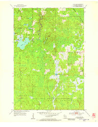
1954 Map of Lyman Lake
USGS Topo · Published 1955About this map
The Minneapolis St Paul and Sault Ste Marie railroad cuts across the northern corner of this mid-century Douglas County landscape, serving as a primary transit artery through the dense township of Hawthorne. The area is defined by its complex glacial hydrology, where the Amnicon River and Little Amnicon River flow through the township of Oakland, feeding into the prominent basin of Lyman Lake. To the south, the terrain becomes more wetland-heavy, marked by the headwaters of the Moose River and its East Fork.
Find a feature on this map
22 named features on this map. Tap any name to fly to it.
Don’t see what you’re looking for? This feature index may not catch every label — zoom into the map to look around manually.
Map Details
Editions of this 1954 Lyman Lake Map
This is the sole edition of this map. No revisions or reprints were ever made.
Other maps of this area

1915 · Superior
USGS Topo · 1:48,000

1917 · Superior
USGS Topo · 1:62,500

1945 · Solon Springs
USGS Topo · 1:48,000

1949 · Solon Springs
USGS Topo · 1:48,000

1949 · Patzau
USGS Topo · 1:48,000

1949 · Poplar
USGS Topo · 1:48,000

1953 · Ashland
USGS Topo · 1:250,000

1953 · Duluth
USGS Topo · 1:250,000

1954 · Sunnyside
USGS Topo · 1:24,000

1954 · Amnicon Lake
USGS Topo · 1:24,000