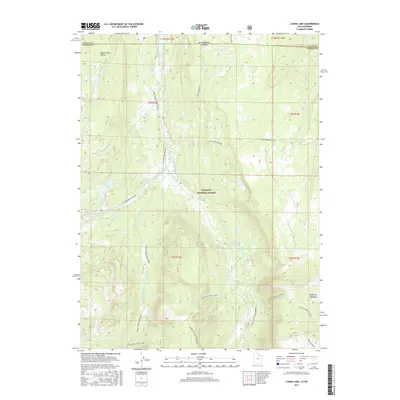
2017 Map of Lyman Lake
USGS Topo · Published 2017About this map
Lyman Lake and Little Lyman Lake sit within the high-elevation terrain of the Wasatch National Forest, where the headwaters of several major forks of the Blacks Fork river system emerge. This modern survey illustrates a landscape primarily defined by its hydrology and seasonal access routes. The northern reaches are dominated by the Meeks Cabin Reservoir, which crosses the state line between Utah and Wyoming.
Find a feature on this map
32 named features on this map. Tap any name to fly to it.
Don’t see what you’re looking for? This feature index may not catch every label — zoom into the map to look around manually.
Map Details
Editions of this 2017 Lyman Lake Map
This is the sole edition of this map. No revisions or reprints were ever made.
Other maps of this area

1885 · Uinta
USGS Topo · 1:250,000

1901 · Hayden Peak
USGS Topo · 1:125,000

1903 · Hayden Peak
USGS Topo · 1:125,000

1905 · Gilbert Peak
USGS Topo · 1:125,000

1906 · Gilbert Peak
USGS Topo · 1:125,000

1954 · Salt Lake City
USGS Topo · 1:250,000

1954 · Ogden
USGS Topo · 1:250,000

1958 · Ogden
USGS Topo · 1:250,000

1958 · Salt Lake City
USGS Topo · 1:250,000

1960 · Ogden
USGS Topo · 1:250,000